RAILWAY ARCHAEOLOGY IPSWICH (QLD)
Alister J Cameron
PLEASE NOTE: This is a large map and will take time to load.
INSTRUCTIONS: As these are GIS vectors they will retain resolution at high zoom. Click on a vector for further information about it.
Zoom right in and click on this symbol & contained blue link to open the relevant page. You may have to click several times to bring up correct item.
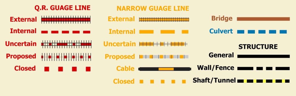
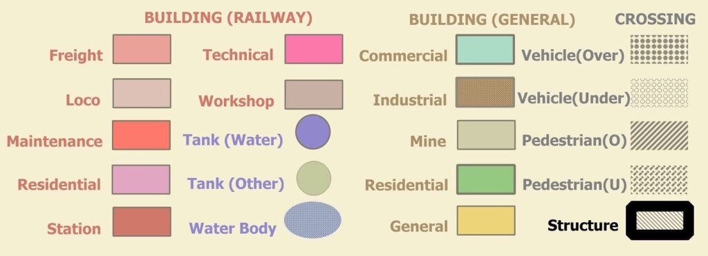
Overlay: QGIS Vectors (Alister J Cameron)Underlay(A): DP South Qld 5m Contours; Qld Spatial Catalogue; Qld Government.Underlay(B): Qld Property Boundaries: Digital Cadastral Database Lite; Qld Dept of Natural Resources & Mines 2017